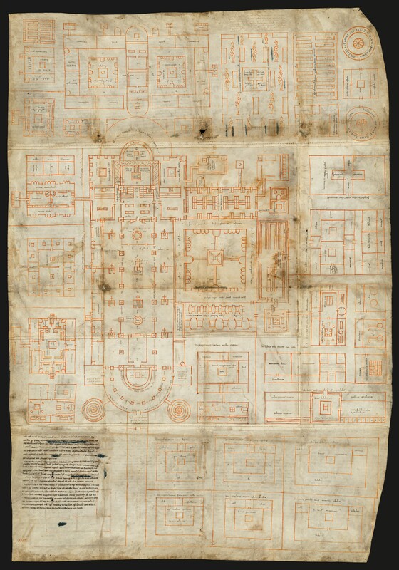
Plan of St. Gall
Type:
Maps and plans
Date:
816–37
Location or Findspot (Modern-Day Country):
Germany
Medium:
Parchment
Dimensions:
112 × 77.5 cm
Description:
The Carolingian Plan of St. Gall, drawn on five stitched-together pieces of parchment, was not created as a blueprint for an actual monastic complex but rather as an idealized monastery. According to one of its inscriptions (of which there are over three hundred), it was produced for Gozbert, almost certainly the abbot of St. Gall (r. 816–37). It was likely made at the nearby monastery at Reichenau during the abbacy of Haito (r. 806–23). Some of its notable features are the large basilica dominating the plan, the monastic cloister to the south of it, the large school to the north, and the scriptorium labeled "sedes scribentium."
Relevant Textbook Chapter(s):
5
Repository and Online Resources:
• The plan is now in the St. Gallen Stiftsbibliothek.
• Explore the digital Plan of St. Gall.
Image Credits:
St. Gallen Stiftsbibliothek; Navid Jamali


