Map of Jerusalem
Type:
Cities,
Maps and plans
Date:
Late twelfth century
Location or Findspot (Modern-Day Country):
France
Dimensions:
25.5 × 16.5 cm
Description:
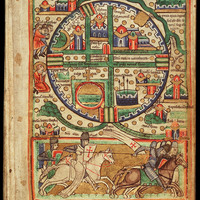
A series of images painted in a French monastery in the late twelfth century, probably for a Psalter or picture Bible, includes a detailed map of Jerusalem (now The Hague, Koninklijke Bibliotheek, MS 76 F 5, fol. 1r). The city is shown in a bird's eye view, but with buildings seen from the front or side. City maps were rare in this period, but about fifteen maps of Jerusalem were included in manuscripts in the eleventh and twelfth centuries, after the Islamic city had been conquered by European Christians in 1099. These maps documented Christian (re)possession of the Holy Land by representing sacred Christian sites: in fact, the label at the top says "Locus quadragesime" (Topography of the Passion, in Latin). The Hague map, like the others, makes ideological claims but nevertheless contains some reliable historical features.
Jerusalem was not circular, but it did have five gates and main streets that intersect at right angles, dating back to the Roman-era city plan. The building at the upper center labeled "Templum Domini" (Temple of the Lord) is the Dome of the Rock, built atop the Jewish Temple in the late seventh century and rechristened by the crusaders. To its right (south), the "Templum Salamonis" (Temple of Solomon) is the al-Aqsa Mosque, which became the crusaders' palace. In the lower left quadrant of the circle, the large gold cross atop a red circle marks the Holy Sepulcher complex, rebuilt in the twelfth century. To its left, the haloed St. Stephen is being stoned by the Jews (Acts 7).
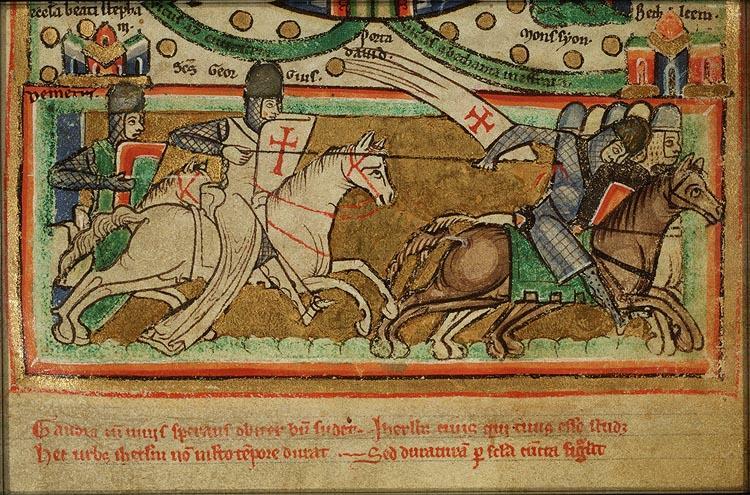
At the bottom of the page, two labeled saints—George, holding a shield and lance marked with the red cross of the Templars, and Demetrius—symbolically lead the Christians against fleeing Muslim soldiers. Both saints had miraculously appeared at the battle of Antioch (1098) to turn the tide in favor of the Christian forces.
Relevant Textbook Chapter(s):
7
Repository and Online Resources:
• See other pages in this book (and zoom in on this one) on the National Library of the Netherlands website.
Image Credits:
he Hague, Koninklijke Bibliotheek (National Library of the Netherlands)


